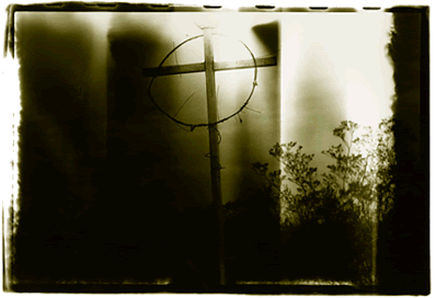
La Linea Fronteriza
SPECIAL FEATURE
|
|
|
|
Whether it's the shallow river that separates Texas and Mexico, or the intermittent series of fences that divide the Arizona-Sonora desert, many cross the line, but what is the line?
The modern boundary was agreed upon by the two nations under the Chamizal Treaty in 1963, but the surveyors' line that divides the U.S and Mexico has little ability to keep the two nations apart. At the border, the currency is different yet shared; the languages are different yet shared; the social and environmental issues are different yet shared.
We will explore the border, which people on the Mexican side - and increasingly on the U.S. side - refer to as la frontera, in historical and cultural perspective.
THE RIVER
Texas and Mexico are divided by 1,254 miles of the Rio Grande, which originates high in the San Juan Mountains of southwestern Colorado. The river provided a reliable water supply for indigenous populations, Spanish and Mexican communities, and the predominantly Hispanic and Anglo populations that settled the modern boundary.
Fed by the spring snowmelt and summer rains, the river flows south through New Mexico, dividing the state in half, providing water to arid lands through historic and modern irrigation systems.
Puebloans called it P'Osoge, "river of great water," and the Spanish followed its course along the badlands of New Mexico through a stretch they called the Jornada del Muerto, "Journey of Death," as they colonized the Pueblo Indians.
For centuries, the river has been the life source for the agricultural and historical communities of the Mesilla Valley, one of the oldest irrigated lands in the U.S. The historical region extends from Las Cruces, New Mexico to the communities south of El Paso, where Ysleta, Socorro and San Elizario are among the oldest European settlements in Texas. Around the missions of Corpus Cristi de la Isleta and Nuestra Señora del Socorro, the modern communities were established in 1681 and 1682 following the Pueblo Revolt in northern New Mexico.
From El Paso to the Gulf of Mexico, the Rio Grande forms Texas' border with Mexico.
The Rio Grande, which is mistakenly called the "Rio Grande River" by many Americans, has been known by different names in Spanish journals and maps.
|
In 1582, Antonio de Espejo followed the Rio Conchos to the Rio Grande, which he called Rio del Norte, or "River of the North." Near El Paso del Norte, New Mexico colonizer Juan de Oñate named the Rio Grande, as it is known to Americans today. The Spanish also called it Rio Grande del Norte, and different stretches of the river have been called Rio San Buenaventura and Rio Ganapetuam. Giving a consistent name to the nearly 2,000-mile long waterway, the second longest in the U.S., illustrates the difficulties the Spanish faced in their efforts to colonize and map New Spain, a and many times the size of old Spain.
In Mexico, the Rio Grande is commonly known as Rio Bravo. The Rio Conchos, Rio Salado and Rio San Juan are the main tributaries to the Rio Grande on the Mexican side, where 75 percent of its waters originate below El Paso. The U.S. impounds and distributes a significant portion of the river's volume in New Mexico.
In the development of the modern American West, dams have been built along major rivers to gain control over the precious water resources of western states. Behind the dams, lake levels are falling, and in front of the dams, rivers like the Rio Grande and the Colorado River barely reach the ocean.
THE BORDER
|
Politically and logistically, the border forms a zone with immigration checkpoints in the interior on both sides. On the Mexican side, authorities have placed great expectations on the North American Free Trade Agreement (NAFTA) to bring investment and improve conditions within the border zone, la zona frontera.
The North American Development Bank (NADB) was created under NAFTA to build water and wastewater systems in the border zone. Mexican President Vicente Fox believes Mexico would benefit if the bank's role were expanded to include economic development, transportation and communications infrastructure.(1)
In 2001, Commissioner Ernesto Ruffo Appel, with the Commission for Northern Border Affairs (Comision para Asuntos de la Frontera Norte, CAFN), announced that Mexico would like to expand the definition of the border zone from 60 miles to 180 miles in order to include more of Mexico's infrastructure in the bank's development plans.
HISTORY
Long before the American Revolutionary War and Mexico's independence from Spain, many Hispanics were born in the southwestern United States under Spanish governance. The cultural dynamics of the modern American Southwest were formed by New Spain, as Spanish and Indian cultures advanced and retreated many times during the episodes of its history. Major events (such as Coronado's expedition of 1540) saw indigenous populations accompany Spanish armies on conquests of distant lands, and revolting Indians (such as participants of the Pueblo Revolt of 1680) expel their colonizers back to the familiar confines of the Rio Grande.
Mexico's northern boundary was moved south several times between 1821, when it won independence from Spain, and 1854, the date of the Gadsden Purchase. During that period, many citizens of Mexico were born in the region that now includes Texas, New Mexico, Arizona and California. During that time, Texas fought for its independence from Mexico and the United States fought to establish the Rio Grande as its southern boundary.
The boundary between the United States and Mexico was permanently defined in 1963 by the Chamizal Treaty, but the extent of Mexican and Hispanic culture has never been defined.
For centuries, Mexicans have crossed the modern boundary for family and religious reasons, and for much the same reasons pre-Hispanic people settled all across Mesoamerica - to work and find opportunity for a better life.
|
||||||||||||||
Sources:
1. Borderlines 81, vol 9, num 8, Sept 2001,
http://www.americaspolicy.org/borderlines/2001/bl81/bl81progress_body.html
Copyright © 2004 by Mark Lacy and Houston Institute for Culture.